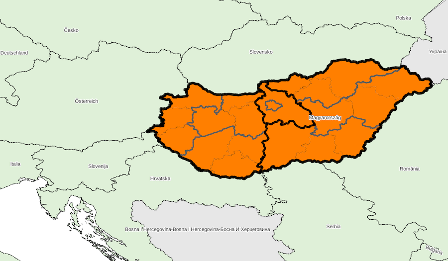
Administrative divisions, country «Hungary»
Identifiant: HU, code ISO: HU, code Geonames: 719819, code OpenStreetMap: R21335, code Wikidata: Q28
Unique local geographical referential: HD72 / EOV [EPSG 23700, commune x 3,177]
Quantities by sublevel: super-région x 3, région x 7, département x 20, commune x 3,177
External referral rate of communes: Geonames 0 %, OpenStreetMap 0 %, Wikidata 0 %, neither 100 %
DIVISIONS ADMINISTRATIVES
- super-régions (NUTS 1) : Statisztikai nagyrégiók
- régions (NUTS 2) : Tervezési-statisztikai régiók
- départements (NUTS 3) : Megyék + Budapest
- communes (UAL 2) : Települések
SOURCES
- Eurostat NUTS
http://ec.europa.eu/eurostat/web/nuts/
- Központi Statisztikai Hivatal
http://www.ksh.hu/
http://www.ksh.hu/apps/shop.kiadvany?p_kiadvany_id=81322&p_lang=HU
- WikiPédia magyar
https://hu.wikipedia.org/
Super-region list for country «Hungary»
Download with format CSV for spreadsheet or simple, XLSX, XLS, ODS
| ID | NOM | ASCII | GNM | OSM | WD | X_WGS84 | Y_WGS84 | ISO | ID_LOCAL | NB_REG | NB_DEP | NB_COMM | INFO |
|---|---|---|---|---|---|---|---|---|---|---|---|---|---|
| ID | NOM | ASCII | GNM | OSM | WD | X_WGS84 | Y_WGS84 | ISO | ID_LOCAL | NB_REG | NB_DEP | NB_COMM | INFO |
| HU3 | Alföld és Észak | ALFOLD ES ESZAK | - | - | - | 0 | 0 | - | - | 3 | 9 | 1,253 | |
| HU2 | Dunántúl | DUNANTUL | - | - | - | 0 | 0 | - | - | 3 | 9 | 1,713 | |
| HU1 | Közép-Magyarország | KOZEP MAGYARORSZAG | - | - | - | 0 | 0 | - | - | 1 | 2 | 211 |
Downloading country data
Database content, in format CSV for spreadsheet or simple, XLSX, XLS, ODS
(please choose CSV format if data volume is too large for other formats)
SIG layers of administrative division: ZIP archive
